Torres del Paine
Posted on February 12, 2019 - Leave a Comment
Trekking in Patagonia
Cliff Lancey
March 14, 2014
The plane lands. It is winter in Atlanta. But that was 18 hours ago. Overnight we have flown clear of winter, over spring and even much of the summer. There is the feel of Autumn here in Patagonia.
We are in the town of Punta Arenas, Chile. It is about as far south as a man can go and still call a cab. With the exception of Ushuaia, a cow town a hundred miles or so away, Punta is the most southerly city on the planet. Like all far-flung places, it not only looks different, it feels different. People are still driving cars, buying groceries, walking dogs. But there is a different vibe. They love dogs. They are like sacred cows. There is no leash law. Dogs roam the city streets, snoozing in the doorways, lounging on sidewalks, sniffing passersby. On every corner there is some old mutt fast asleep on a busy sidewalk. The architecture is potpourri, almost motley. Here a hulking Spanish Colonial palazzo, now converted to a school, next to a curious, gabled pile, the home, a century ago, of one of those misfit seafarers who ran out of time and ocean. 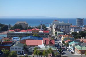
Jim and I grab a cab at the airport. We negotiate a price in what passes for our spanish, and head toward downtown. Ken wasn’t in baggage claim even though he departed Santiago well ahead of us. There is no cell service. If he made it, he’s in baggage or in the hotel bar.
Just outside the airport the ocean appears. The ocean is everywhere at the southern tip of South America. But this is not merely the ocean, it is the Strait of Magellan. Here for several hundred years – until the Panama Canal – was the safe route to the Pacific, preferred to the wilds of Cape Horn. Magellan discovered it during the first circumnavigation of the world in 1520. Across the Strait in the distance is a dark headland, Tierra del Fuego. The Land of Flames.
Punta was built after an earlier settlement farther south collapsed. We visited the original settlement at Fuerte Bulnes. It looks like an old Western fort of rough logs behind a stockade. Only a few miles farther south is Cape Froward, the southerly tip of the South American continent. Cape Horn lies beyond, in an archipelago which runs up the Chilean coast.
They are making a movie in Bulnes. In a side yard of the fort a handful of actors in pioneer clothes are lounging around, munching sandwiches. A log hut and the ground nearby are covered in a blanket of Hollywood snow. A technician wrestles with a machine which is intermittently spitting out white wisps of something. It isn’t going well. 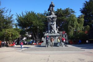
Its a Chilean TV drama about Puerto del Hambre, another historic site just up the road. Here the Spanish built a military post in 1584. When an English ship arrived in 1587, everybody was dead – starved or frozen. The name means Port Famine. We stopped to visit. There’s not much. If we were expecting a Port Famine Kentucky Fried Chicken, we were disappointed. A weather-worn plaque describes some ruins. A steep hill drops to a rocky tidal flat. On a barren knoll is a small cemetery. It is a bleak place.
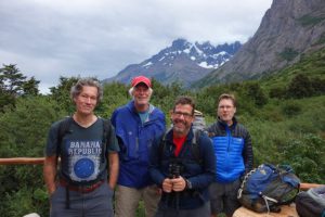
Tomorrow we leave Punta Arenas on a 9-day trek in Torres del Paine. It’s pronounced PI-knee. Ken, Jim, Randall and I are old friends. We have been hiking together since the 70s.
Torres del Paine is a national park. It is a “cordillera” or range of the Southern Andes. The profusion of glaciers has sculpted the mountains into jagged granite peaks and ridges. There are 48 glaciers in Torres. Some are small “hanging” glaciers, not much more than snowfields caught in the teeth of the ridge. Others, like Glaciar Grey are breathtaking.
At Paso John Gardner we got our first glimpse of Glaciar Grey. It is the vista of another world. From Lago Grey it stretches back into the Andes as far as one can see – a river of ice miles wide. It is a frontier. The hide of a glacier is ridged and rough. By definition it is moving, and as it moves, the ice crumples and fractures, leaving crevasses hidden under the snow. It is a dangerous, no-man’s land. 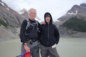
The toe of the glacier rises a hundred feet or more above the lake. A boat from a nearby refugio takes visitors for a closer look, but not too close. The ice breaks off in calves, as they call them, which plunge into the lake. At the other end of the lake, the wind has blown a cove full of icebergs.
The first day was 20 miles to Lago Dickson – a very long walk. Half the day it rained. We climbed over ridges, through bogs, across streams and meadows. Lunch was in a cramped hut at Puesto Seron, eight miles in. We were almost shoulder to shoulder, but happy enough to be out of the rain. It was raining hard when we left, but above Seron it stopped. We climbed up and down a rocky ridge. Lago Paine glittered in the sun below us. We arrived at the campsite, Refugio Dickson, at 7. We had started at 8:30.
It was a pleasant camp. Pleasant doesn’t actually express it. Wherever we can drop the packs and stop hiking is hallowed ground. The tents lie in the trees at the edge of a field. In the center is the Refugio, a small building with bunks and a shower room. A few feet away a smaller hut, almost a kiosk, sells beer and Gato, a box red wine. Jim, a wine guy, waves off the Gato. I could have bathed in it, drank it till I hallucinated.
Everything is sore. But that’s why they make ibuprofen, hot showers and Gato. There was wine in the dinner tent. God bless the porters. We stepped outside into the dark. Somebody pointed to the Southern Cross.
There are twelve in this trek group. Mom, dad and two college sons from San Francisco, a vet from Santa Cruz, a free spirit from Boulder, a doc from Florida, a woman doc from Germany, and us. There are several porters, whom we see in the evening, and three guides, Daniell, Christiane and Oche. 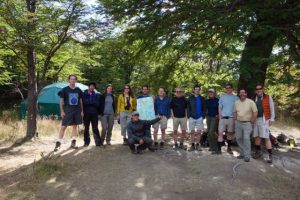
The second day was 8 miles. A nice break. We are following the “Circuit”, an almost 80-mile circle around the mountain range. We started on the east side, near the park entrance, and headed north and west along Rio Paine. Today we continue southwest, along Rio de los Perros to the campamento.
We enter a forest threaded by streams. There are homemade bridges of logs nailed together. These bridges – and there are a hundred of them – are a sketchy business. They are built with whatever comes to hand, logs, planks, rope, chicken wire. There is water everywhere. Here in late summer the glaciers melt, which makes for torrential streams and bogs. It is up and down. We scale several canyons with homemade ladders of pipe and wire. They are pretty solid, but they don’t look so good. They are meant to be fastened with bolts to the rock, but the brackets are all empty. They are lashed together instead by cables and rope tied to abutments at the top. The first steps down the ladder are slow going. It is a long fall, and would certainly hold up dinner. Oche scampers down the ladders like a monkey, facing out stair-wise, holding everyone’s walking sticks in one hand. 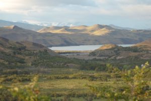
Through the woods, the twelve of us creep along single file. We are something like bugs dwarfed by the landscape. We climb hand over hand up rocky passages, cross foaming streams, while overhead torrents of water spill from the melt.
There are three women in the group. One belongs to the Bay Area family. The other two are solo. One is from Boulder, Colorado, a sort of graying hippie. This is probably her thing, living freestyle, between poverty and the delights of the wilderness. The German neurologist is nice enough but not exactly friendly. Germans are just different. Good people, for sure, but not interested in getting to know you.
Also, it takes a special resolve to make this kind of trip if you’re female. Unlike back home, it is still something of a man’s world in the sub-Antarctic wilderness. After dinner men gather together, drink wine, get loud and talkative. The women retire early. They are not shy. Perhaps it is just not their world. I think of my wife. An exception to the guarded-ness of women. She would be up all night, drinking and laughing, oblivious that all the women had retired – and then be up at 6 in the morning ready to go. No shyness I have ever detected. But she’s not a trekker. Its a shame.
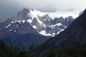 The Los Perros camp is in a grove of trees. A hundred yards away the river lies behind a field of high grass. Not far beyond rises a granite wall. To one side, behind a slope, is Glaciar Perros. We saw it on the approach. It rises overhead, a crest of ice in ethereal tints of blue. As the late sun lit up the wall, we climbed a steep moraine to see the glacier up close. We had to settle for the lago. It lay in a bowl, like soup, thick with the fill carried from the glacier.
In the middle of the camp the porters have tied a slackline. It’s a long nylon strap winched between two trees. They walk it like a tightrope. It is a test of strength and balance – the skills that make good porters. These guys walk phenomenal distances up and down the mountains carrying all the stuff that, well, we older guys are willing to pay someone else to carry. 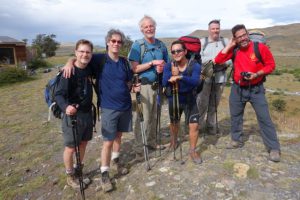 Christiane, one of our guys, is bouncing side-saddle. He tosses himself in the air and lands standing on the strap. He teeters there for a moment, dances a few feet, loses his balance and hops off. Nearby a Chilean girl watches the young men. She helps the cook. You can see why these boys risk breaking their ankles on the slackline. Chilean women are slender, shapely, dark-skinned beauties. Or maybe its the Chilean blue jeans. We debate this among ourselves at some length.
A short boyish-looking fellow in official green with epaulets asks us to sign a book. It is the only evidence of civil authority. This is a premier national park, yet to all appearances the enterprise is run by the young men who work for the trek companies. Though there is no sign of the authorities, neither is there sign of any need. All of the Chilean guys – every one of them – are smiling and friendly. Each has a role in keeping the trekkers fed and on task. Most of them come from Puerto Natales and other nearby towns, where good jobs are scarce. By dint of strength and endurance they hold jobs as porters, happy, it appears, to make good money taking long walks in the mountains. They’re mostly contract guys, signing up with this group or that. Carrying a third of your body weight for 20 miles is not easy. But these guys have legs like soccer players. Some of them even carry big rocks on the trail, in their hands, just to show off. In the winter they migrate to the ski resorts. 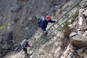
Torres del Paine has few rangers and little overt bureaucracy. But there are rules. They don’t like smoking. Alongside the trail, in the absolute middle of nowhere, Ken asked Daniell if he might smoke. Daniell, without his usual tact, flat out told him no. The one thing they fear, apparently, is fire. Although there are streams at every turn, it is not runoff but melt. The climate is actually dry. Daniell does not want the distinction of leading the group that burned the forest down.
The morning of the Paso we wake at 5:00. It is still dark when we head into the woods. Daniell has simple instructions. Wear everything – raincoat, rainpants, sweaters, hat and gloves. Expect the worst.
The swaying beams of headlamps guide us through a muddy bog. Everybody has a lamp – and ski poles. Everyone except Andy. He is in shorts and leggings.
He is an emergency room doc from Florida. In his early 50s, he has hair to his shoulders. In a floppy canvas hat and shades he looks like Carole King. He describes himself as one of those rootless Jews who were raised nowhere and everywhere. If he is to be believed, his mom divorced when he was young, married a guy who lived in India, where he spent a few early years. He went to live with his sister on a kibbutz. Later they migrated to Spain. In some places he didn’t even go to school. But he got in to Brown – no easy task – and later med school. He studied geology and spent time mapping in Alaska. His father couldn’t pay the tuition, so he went to Bolivia, where he discovered that with the right spiel the customs agents would let him import alpaca sweaters to sell to his Ivy League classmates. You can tell he’s smart, even if he is making all this up. He’s a loner. Booked a space at the last moment. Brought virtually nothing, and in fact borrowed a raincoat from Randall. Just wanted to take a walk, as he explains the decision to join the trek. Andy doesn’t even have poles. On the sometimes hand-over-hand scramble up the steep trails, he is like a goat. Not so the rest of us. It is brutal on the knees. Without our nifty spring-loaded, telescoping walking sticks, it would be almost impossible. I thought the guy was fascinating to talk to. Gave me his theory of pharmacology – which was basically don’t take anything. Imagine, a doctor who says we take too many pills. My psychiatrist pals don’t have a good thing to say about him. They think he’s a phony. They could be right for all I know, my ignorance, gullibility and naivete can be pretty impressive. But it is also obvious that Andy represents something that disturbs them. He’s a bright, accomplished guy, who lives pretty much as he wants. His life may be an act, but he writes the script. Talking to Andy gives you the vague feeling of looking through the bars of your own prison.
As dawn breaks, we are out of the woods and onto a flank of mountain. Streams of melt spill everywhere. It is hard to get used to the availability of water. No filters, no boiling, no iodine. The water is good, “dulce” as Oche says. Sweet.
We climb all morning toward Paso John Gardner, the highest and hardest part of the trek. It is so difficult the park won’t let you do it solo, though who would actually stop you is a good question. We are lucky. The weather is good. The wind is sharp, but the sun is out. Below the pass we refill water at a tiny stream. Off come the clothes and on with a dry tee-shirt. On with another shirt, then coat, hat, hood and gloves. With everything zippered up and buttoned down, we head up to the Paso.
The wind picks up, slowly at first. But as we approach the pass it becomes incredible, with gusts like hammer blows. The din drowns out the yells and whoops. At the summit it is hard to hold your balance. We are at the top of the bottom of the world. Fatigue vanishes. We stop for pictures. It’s something like victory. At the far edge of the pass, Glaciar Grey comes into view. The frozen river runs from the intangible distance into the valley below our feet. It has no beginning but seems to flow from the top of the Andes themselves. In this wonderland there is only snow and rock and blue sky. Nothing else, except the few of us, trying to find balance in the wind. We are bits of colored paper on an immense white canvas. 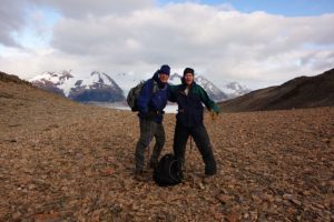
Then it is down, down and down. A couple of hours of down, over rocks and roots, clutching monkey lines, knees in protest, to Refugio Grey. There is a lodge. It has been 22 kilometers. Whatever that is, maybe 14 miles. Converting the metric system is the reason more Americans don’t live here. 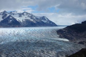
A kilometer is .62 to the mile. That’s hard enough. Then there’s the Chilean peso, at 550 to the buck, or 1.8 or technically .0018 the other way. They’ve got to be getting fat on the fractions. Tourists blowing the math is probably a line item in the Chilean current account surplus. Floats the merchant marine. Finally, there’s the temperature. Celsius. Multiply an afternoon’s 17 degrees by 9 over 5 plus 32. Seriously. By the time you work that out in your head, the temperature has changed.
Its around 6:00. We started at 7 this morning. We kick back in the tents, a little dazed. But a hot shower and a handful of ibuprofen snaps us back. We revive for dinner in the lodge, drink some Chilean wine, loiter on the front deck, but we’re off pretty quickly to sleep.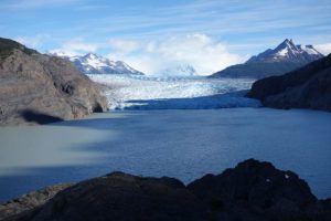
Tomorrow is a shorter day, heading to Paine Grande. We’ll spend much of the day humping up and down the ridge along Lago Grey, with the mother glacier shimmering like a dream over the right shoulder. It is a day of great views of the Patagonian countryside. Green lake, rolling russet hills, and Olympian peaks jutting out of the horizon. The timberline this far south is pretty low. The trail weaves through spiky shrubs and bushes crowded with red berries. Some are quite edible, Daniell says, but others will kill you quick. His English just isn’t good enough to be totally sure which is which.
Los Cuernos, the horns, is a trio of jagged peaks, striped with granite, that tower over this corner of the park. 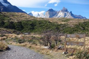 Its a long day, with an up-and-return along the Valle del Frances (Fran-CES). From Paine we reach Camp Italiano by late morning. Glaciers and peaks dominate the view to the left. Near Italiano is a big waterfall, thundering into a gorge. The spray hangs in the air like a veil. One of the group whose feet are in bad shape stays at Italiano while we make the trip up to Mirador Frances. Frances is an hour or so hike along the base of a tremendous hanging glacier. At the viewpoint – the Mirador – you can look back and pick up lakes stretching into the distance. Frances is very cool. The trail is virtually in the shadow of the glacier that sits high in the opposite wall. It “hangs”, which means it has plowed to the crest of the ridge, where it is suspended over the valley. It does not have a terminus in a lake, but looms like a frozen wave. A dozen waterfalls cascade down the mountain below it. Every few minutes we hear a rumble. It is not thunder. It is an avalanche. It is still summer and the snow grows heavy. We look up hoping to see one. But we are seeing only the leading edge of the glacier. Once a wisp of powder seemed to mark the moving snow, but it’s hard to tell.
The doughty Bay Area boys and their mom continue the extra hour to Mirador Britanico. But it is beginning to rain. There’s not much of a mirador if its raining. We head down the valley. It’s still hours to Los Cuernos where we camp.
I bought the porters a beer at Cuernos. They are a ruddy friendly bunch who don’t have three words of English among them. They are sitting on a low wall. Between the wall and the refugio is a patio of sorts, a gathering spot. It is also the trail, sort of like the road to town running through your kitchen. While we sip beer, hikers come through. In the bushes around the refugio, tents are pitched on platforms. There isn’t any flat ground. The refugio has a dining room, bathrooms, and a closet sized bar. Just downhill is the lago and a pebbly beach. Its a cozy place. Behind us the peaks glow in the evening sun. Clouds grab at the horns. They stop and gather. Maybe its rain. But the weather still holds.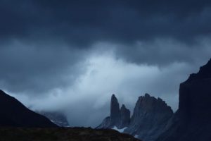 At Paine Grande last night the sky darkened and a heavy carpet of cloud rolled over the campsite. A few raindrops plopped in the dust. Daniell describes the difficulty when the weather goes bad. It rains hard, the wind blows, turns cold, and snows. The trails become muddy and slick. The guides rope clients across swollen streams. He laughs to recall a 75-year old woman’s profanity after being roped across a river.
The best is last. The Torres del Paine, for whom the park is named, are three peaks in the center of the park. They are huge granite pillars that can be glimpsed from various parts of the park, but never in full. The last day takes us up the Rio Ascensio to the base of the Torres. We rise early. We head immediately uphill scaling the flank of the valley. It is a form of Chilean torture to march us to the top of the ridge and then march us back down to the river. We take a break at Chileno and fill our waterbags. Chileno is a campground and a small building next to the river housing a few tables, a kitchen and a window serving coffee and wine.
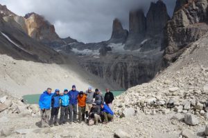
We head back up to the ridge. The trail winds through a forest. It has a storyland feel to it. It is Lenga forest. The Lenga grows high with a full canopy, but has few low branches. Thus it feels both dark and wide-open at the same time – a place where the faeries might play. The trail emerges onto the sunny hide of ridge overlooking the valley. The opposite wall is impossibly sheer. It is more a canyon. The trail turns steep. We are climbing a rocky staircase, knotted with roots and bushes, grunting as we haul ourselves over the boulders. The trail spills into the open. There are tufts of grass, nothing more. The wind picks up, and gives us a sudden blast. We can hear it rattling the trees below. We look hopefully for the top. As we approach the top the trail vanishes into a trace over rocks. Here and there an arrow points across the boulders. The weather prediction was rain, but still our luck holds. The trail disappears around a bend and turns down. We are suddenly standing before a green lake at the foot of the three granite spires. These are the Torres del Paine. 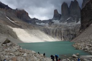 We find a spot sheltered from the wind and drop the packs. The clouds are moving quickly as the sun drifts along the gray wall. Christiane slices a pineapple and passes it around. It is a splendid spot, green water beneath a blue sky under gray peaks. Other trekkers have arrived and are lounging around on the rocks next to the shore. A few feet away a busy stream carries more water away. Too soon, the afternoon is upon us and we begin the long march home.
 It takes almost the entire day to drive back to Punta Arenas. We stop in Puerto Natales. In the tour office on a dusty side street is a dark room with a small table. Alongside is a smaller room with a couple of women at desks working the phones and computers. There are envelopes on the table where we stuff tip money. There’s no hustle to it. The guides are good fellows who earn every dime.
